A visitor website concept for Belize Audubon Society Discover Belize Audubon Society →
Belize Audubon Society
Menu +
EN / ES
FROM REEF TO RAINFOREST

Find your place in the wild.

Seven protected areas. One remarkable Belize. Explore the landscapes, the experiences and the stories behind them.

Explore the Blue Hole Trust map ↗Reef science & conservation
Seven BAS protected areasOrientation map from Natural Earth geography and documented park locations. Select a number to read the park guide.BELIZEGUATEMALAMEXICOCaribbean SeaBlue Hole Natural Monument1Half Moon Caye Natural Monument2Cockscomb Basin Wildlife Sanctuary3Victoria Peak Natural Monument4St. Herman’s Blue Hole National Park5Guanacaste National Park6Crooked Tree Wildlife Sanctuary7Natural Earth · BAS / UNESCO / OpenStreetMap / GeoNames
Your map
Choose your view

An overview of land & sea

Places & paths
Landscape & orientation
Reef & island habitats
0.25 to <1 ha1 to <10 ha10 ha or larger
Below the surface
Marine protection
Science & history
Map symbols 1Protected area ✦Experience ↗Gateway ◇Science & nature
Layer dates, sources & downloads ↓
Places ↓
Protected areaBlue Hole Natural MonumentPhotos, stories & visit details ↓
Scroll or pinch to zoom · drag to exploreOrientation guide · check access with BAS
Lighthouse Reef · Protected area

Blue Hole Natural Monument

A deep-blue circle surrounded by shallow reef, far offshore at Lighthouse Reef.

↑ Back to the map
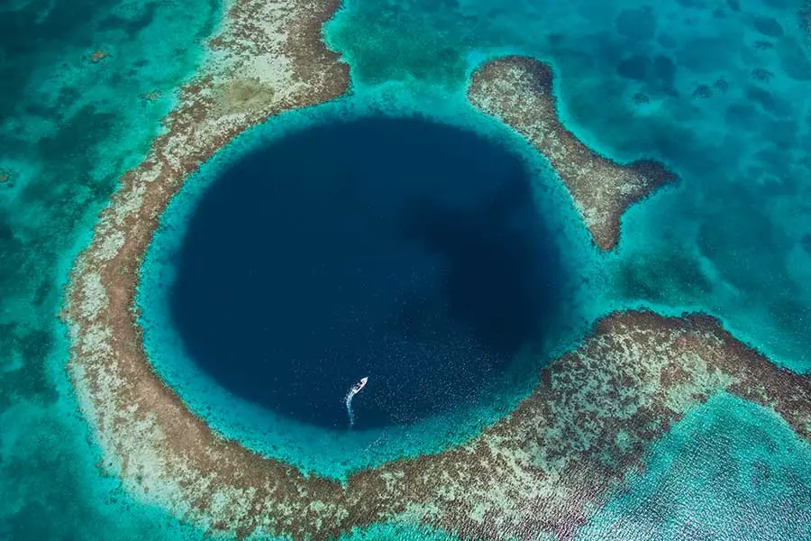
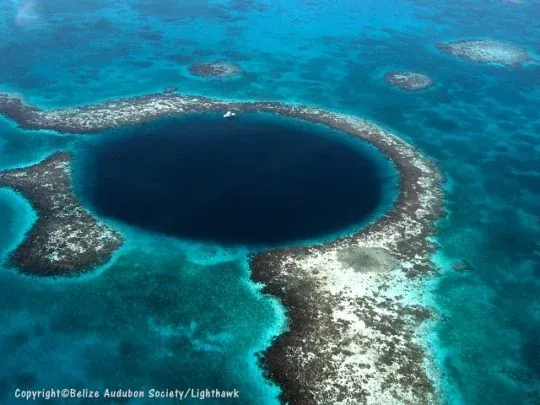
Blue Hole’s deep-water circle and shallow reef rim, seen from the air.
Blue Hole’s deep-water circle and shallow reef rim, seen from the air. · © 2012 Tony Rath / tonyrath.com · BAS photo archive

A closer look

A flooded limestone cave system records an older landscape. The monument became protected in 1996 and forms part of the Belize Barrier Reef Reserve System World Heritage property. Surface snorkeling, aerial sightseeing and diving are different experiences: plan the one that fits your interests and training.

Make the most of your visit

Arrange a licensed marine operator. There is no island landing or campground at the sinkhole; Half Moon Caye is a separate stop. Confirm current fees and mooring instructions with BAS.

Full park guide ↗ Fees & planning ↗
A CLOSER LOOK

Around this protected area

Video poster
FILM · YouTube2024-08-06 · 5:04

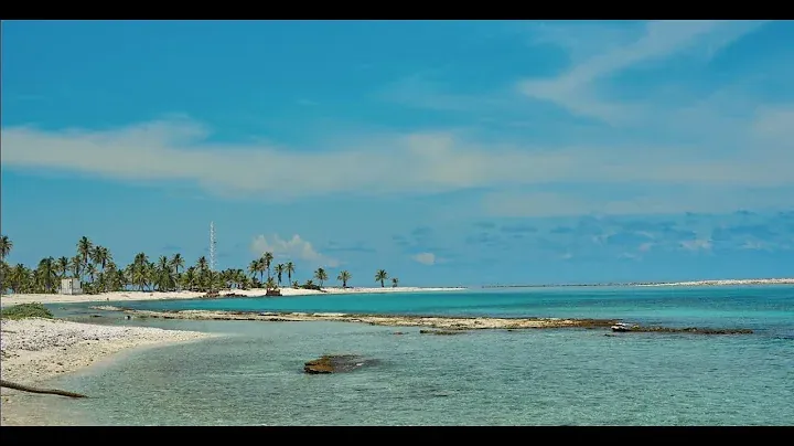
A day at Half Moon Caye and Blue Hole

Scenes from BAS’s public trip on August 4, 2024. This is a past outing, not a current tour offer.

Belize Audubon Society

Audio and any available captions come from the original publisher.
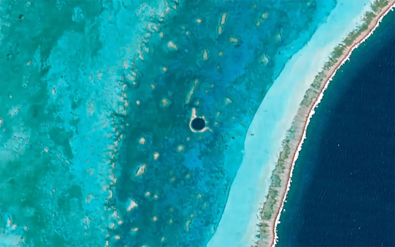
Lighthouse Reef and the Great Blue Hole in a Hodoyoshi-1 satellite image from April 24, 2015. Historical imagery.
Lighthouse Reef and the Great Blue Hole in a Hodoyoshi-1 satellite image from April 24, 2015. Historical imagery.Axelspace Corporation →
Blue Hole’s deep-water circle and shallow reef rim, seen from the air.
Blue Hole’s deep-water circle and shallow reef rim, seen from the air.© 2012 Tony Rath / tonyrath.com · BAS photo archive →
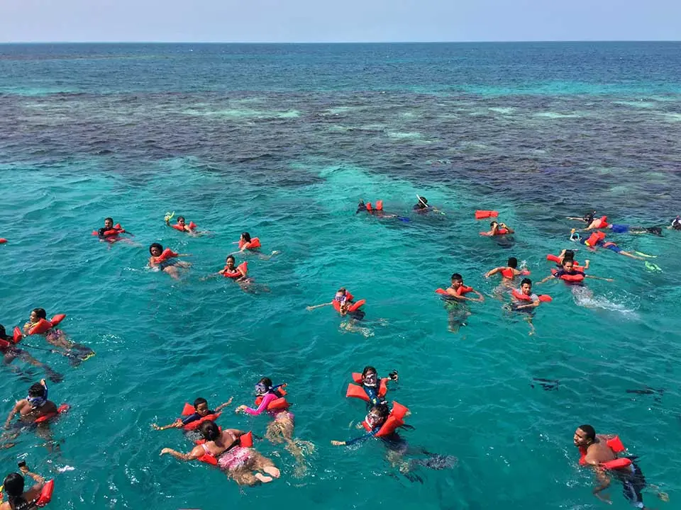
Snorkelers exploring the shallower reef around Blue Hole.
Snorkelers exploring the shallower reef around Blue Hole.Belize Audubon Society photo archive →
The deep-blue circle of the Great Blue Hole and its shallow reef rim.
The deep-blue circle of the Great Blue Hole and its shallow reef rim.Belize Audubon Society photo archive →
Explore the photo & film collection (6 photos) →
A MAP FOR EXPLORING

Know the place.
Care for it, too.

This guide brings BAS visitor information, official photographs and published research together with mapped geographic features. Each place brings together a visitor guide, local documents and its geographic sources.

Before you go

Check openings, weather, guides, fees and permissions with BAS. Marine points are not a navigational chart or a mooring reservation. This map does not identify wildlife in real time or guarantee sightings.

THE LANDSCAPE, IN LAYERS

Look a little closer.

Explore local geography, reef habitats and dated scientific records. Each layer keeps its source and scale; mapped lines are not access permission, a legal survey or a navigation chart.

Islands & cayes

Mapped geographic context, reviewed 5 November 2026. Check local access and conditions.

© OpenStreetMap contributors · ODbL 1.0 · 2026-11-05
Detailed coastline

Mapped geographic context, reviewed 5 November 2026. Check local access and conditions.

© OpenStreetMap contributors · ODbL 1.0 · 2026-11-05
Lagoons & inland water

Mapped geographic context, reviewed 5 November 2026. Check local access and conditions.

© OpenStreetMap contributors · ODbL 1.0 · 2026-11-05
Rivers & streams

Mapped geographic context, reviewed 5 November 2026. Check local access and conditions.

© OpenStreetMap contributors · ODbL 1.0 · 2026-11-05
Mapped woodland

Mapped geographic context, reviewed 5 November 2026. Check local access and conditions.

© OpenStreetMap contributors · ODbL 1.0 · 2026-11-05
Mapped wetlands

Mapped geographic context, reviewed 5 November 2026. Check local access and conditions.

© OpenStreetMap contributors · ODbL 1.0 · 2026-11-05
Roads & park approaches

Mapped geographic context, reviewed 5 November 2026. Check local access and conditions.

© OpenStreetMap contributors · ODbL 1.0 · 2026-11-05
Paths around the parks

Mapped geographic context, reviewed 5 November 2026. Check local access and conditions.

© OpenStreetMap contributors · ODbL 1.0 · 2026-11-05
Town & caye names

Mapped geographic context, reviewed 5 November 2026. Check local access and conditions.

© OpenStreetMap contributors · ODbL 1.0 · 2026-11-05
Regional reefs

Generalized regional reef lines at 1:10 million scale. Not the current reef edge or a navigable passage.

Natural Earth · 1:10 million, Natural Earth 4.1.0
Lighthouse Reef habitat

Satellite-derived patches at Lighthouse Reef, grouped by source area. Classification is not a health assessment.

Álex Giménez-Romero, Manuel A. Matias & Carlos M. Duarte; derived from Allen Coral Atlas Partnership and Arizona State University · 2023 study dataset; Allen Coral Atlas v2 baseline (2018–2020 imagery)
Seafloor depth contours

Approximate depth below mean sea level from the GEBCO grid. Not soundings or a survey of the sinkhole.

GEBCO Bathymetric Compilation Group (2026) · 2026 grid · 15 arc seconds
Cockscomb land cover · 2021

Share of 10 m satellite-classified pixels mapped as trees in each ~200 m display cell. Not canopy density, ownership or present habitat occupancy.

ESA WorldCover consortium · 2021 classification · WorldCover v200
Fisheries management context

Only the perimeter and two separate high-protection zones are shown. This is not a fishing-permission or catch-area chart.

Government of Belize; Belize Fisheries Department · High-protection zones established 2022; outer reserve order 2024
World Heritage reef sites

All seven UNESCO component reference points; only two lie at Lighthouse Reef. These symbols do not depict statutory boundaries.

UNESCO World Heritage Centre · Property inscribed 1996; component table checked 6 Nov 2026
Historical coral heat stress

Annual peak accumulated heat stress (°C-weeks) per NOAA 5-km grid cell at Lighthouse Reef. Historical satellite metric, not a bleaching survey.

NOAA Coral Reef Watch · 2025 annual maximum · product v3.7, released January 2026
Historical storm tracks

Atlantic storm-center fixes near Lighthouse Reef, 2000–2025. Regional segments only; no live conditions.

NOAA National Hurricane Center · 2000–2025 selection; Atlantic archive released 23 September 2026
Coral survey stations · 1999

Nine dated AGRRA field stations; select a point for its reported bleaching percentage and survey date.

van Woesik, Burkepile & Kratochwill / BCO-DMO; original AGRRA surveys · 1999 field observations; dataset v2 released 14 October 2022